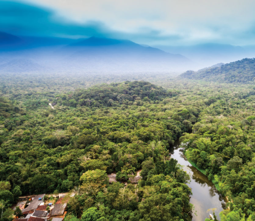
Indigenous Peoples & Local Communities

Documenting and Defending Indigenous and Customary Land

Cadasta partners with Indigenous groups, communities, pastoralists, and other customary groups to document, map, monitor, and analyze community land and natural resources to assert and defend their land claims.

Customary and community land tenure is a set of rules and customs that govern land use and access to other natural resources. Studies estimate that customary practices govern over 50 percent of land in Sub-Saharan Africa. However, most governments do not recognize customary land tenure or community land ownership, with even fewer governments having the community and customary boundaries mapped. 

Indigenous groups are stewards of forests and biodiversity, with 80% of remaining biodiversity living in Indigenous lands and 36% of all intact forest landscapes being managed by Indigenous groups. 

Many communities and Indigenous groups around the world rely on community and customary lands for their livelihood, food, and cultural and religious practices. The insecurity of Indigenous and customary land tenure makes these groups more susceptible to evictions, land grabs, land disputes, and resource extraction.

Cadasta takes a bottom-up approach when documenting community lands by using participatory mapping techniques that include all stakeholders, including women, the elderly, and youth, as well as various interest groups, such as farmers, herders, and forest dwellers. And in line with the FAO’s Free, Prior, and Informed Consent (FPIC) policy, communities have complete control of their data and how it is shared outside of their community. 
With Cadasta’s Technology, Tools, and Services: 

Local communities can document, map, and manage their land claims and advocate for strengthened land rights.

Indigenous groups can map and monitor their community boundaries and defend their claims to resources such as water, forests, and spiritual sites.

Governments can overcome the constraints and challenges imposed by conventional land administration systems to gain a more detailed understanding of community and customary lands.

Our Work with Indigenous Populations & Local Communities: 

Ogiek Peoples' Development Program

Ogiek Peoples’ Development Program

MAU FOREST, KENYA

The Ogiek Peoples in Kenya were in need of tools to document their rights to the Mau Forest. Cadasta training and tools enabled the community to document their claims and protect the forest from encroachment. The project resulted in 3,600 people in 2 communities across 7,699 hectares being documented. The data was later used for community land management and government advocacy.

Documenting forest and indigenous land with partners at Cool Earth in India

Cool Earth

PERU

Cadasta and Cool Earth are working to build and deploy the Rainforest Labs, a bespoke software solution that puts land-use data into the hands of the Indigenous communities that need it most. Each Rainforest Lab equips communities with essential resources like computers, tablets, wifi, digital devices, solar energy, and a base of operations. For Indigenous Peoples and Local Communities to have control over their futures, access to real-time data about their lands is vital. Rainforest Labs bridges a crucial information gap by coupling Indigenous knowledge with tools, training, and technology to effectively manage and protect their Amazonian territories. 

Working with Awajún and Asháninka communities in Peru, Cool Earth and Cadasta collaborate to train and empower these communities with survey design, mapping, and dashboard development. With real-time data, satellite information, and biodiversity monitoring, these communities are better equipped to combat challenges such as land invasion, drug trafficking, and illegal logging. Since beginning work in 2022, the project has trained Indigenous mappers who have generated vital data for 1,000 community members who preserve 11,000 hectares of rainforest and 5 million tonnes of carbon. This data has enabled these communities to respond to 5 major forest loss alerts and document 203 species on the IUCN red list.

Waatavaran

INDIA

Currently, many forest communities in India lack any formal records or proof of their communal and individual forest rights. Waatavaran is leveraging the training and tools offered by Cadasta to more efficiently map and collect community spatial and household data to secure rights for Scheduled Caste and Tribal Communities living in the forests. Using Cadasta’s Esri-based platform, the project is documenting and securing rights for 2,000 households, representing approximately 12,000 citizens.

PRADAN

ODISHA, INDIA

Working to implement the Indian Forest Rights Act, Cadasta’s tools and training helped women, families, and communities establish forest rights and use data to manage their natural resources. The project resulted in the documentation that supports the forest communities to claim and advocate for their rights and livelihoods and create forest and land use plans. To date, more than 4,540 individuals and 908 households have been captured on the platform.

Arch Vahini

ARCH-Vahini

INDIA

Many marginalized communities in rural India lack individual tenure security and documentation of their forest rights. Cadasta worked with Arch Vahini to leverage 3D data and specialized analysis tools to assess and document the placement and effectiveness of earthworks designed to increase production and control erosion of farm plots. The resulting analysis and documentation help demonstrate a farmer’s commitment to investing in the land to strengthen their claims for formal land tenure.