

A proud member of the

Corus International family.

What Successful Land Governance Programs Do Differently

Jul 07 — 2026

Government institutions, development organizations, and communities face increasing pressure to deliver land governance programs that are measurable, scalable, and built to last. Whether the goal is modernizing land administration, recognizing Indigenous lands, strengthening community forestry, or supporting climate resilience, the challenge is rarely a lack of technology. The challenge is implementation.

Research from leading organizations such as the World Bank and the Food and Agriculture Organization of the United Nations (FAO) consistently links secure land tenure with stronger governance, economic opportunity, biodiversity conservation, and climate resilience. What those studies cannot fully capture is how successful implementation actually happens. That is where experience becomes a differentiator.

Over the past decade, Cadasta has partnered with governments, Indigenous Peoples, civil society organizations, and development partners across more than 40 countries to design and implement land governance solutions that reflect local priorities while producing trusted, actionable data. Across those partnerships, one lesson has remained remarkably consistent.

The strongest programs don’t begin with technology. They begin with understanding the importance of place. “Place” is defined as “a specific geographic area over which distinct legal, customary, or social rights of access, control, and ownership exist.” However, a place is never just physical land; it is a bundle of overlapping human relationships, property boundaries, and institutional rules that dictate how that land can be used.

That means listening before mapping, building trust before collecting data, and designing implementation around local institutions instead of asking communities to adapt to external systems. Technology accelerates progress, but partnerships determine whether that progress endures.

Those principles shape every engagement, not because they are a prescribed methodology, but because they consistently produce stronger outcomes across different legal systems, governance structures, and cultural contexts.

The StoryMaps featured throughout this article offer a look inside that work. More than project summaries, they illustrate how implementation decisions, technical expertise, and local leadership come together to produce lasting results.

Trust Produces Better Data


Technology has made collecting geographic information faster than ever. Collecting information that governments, communities, and institutions trust requires something more.

Every successful engagement begins by understanding how local communities define their landscapes. Customary boundaries, seasonal land use, culturally significant places, and traditional governance systems rarely exist in official records, yet they are essential to effective land governance. By integrating community knowledge into the mapping process from the outset, partners produce datasets that are more accurate, more broadly accepted, and more useful for long-term decision-making.

This principle aligns closely with internationally recognized frameworks such as the Foreign Agriculture Office’s (FAO) Voluntary Guidelines on the Responsible Governance of Tenure (VGGT) and the Fit-for-Purpose Land Administration by the World Bank and the International Federation of Surveyors (FIG), both of which emphasize participation, transparency, and locally appropriate implementation.

e6bc8677 e41f 417b 8667 3d497891de35
When Indigenous Knowledge Becomes Spatial Intelligence

In Indonesia, Indigenous youth combine traditional knowledge with digital mapping to document ancestral territories, strengthen community stewardship, and support recognition of Indigenous lands. This StoryMap demonstrates how technical expertise and community leadership reinforce one another to create information that institutions can trust and communities can own. Explore the StoryMap →

Participation Strengthens Governance

Successful land governance programs recognize that participation is not a consultation exercise; it is a critical part of a successful implementation strategy.

Rather than treating communities as data sources, Cadasta works with partners to design processes that build the capacity of local stakeholders to generate, validate, and maintain information that supports future planning and governance.

The result extends beyond better maps. It creates stronger institutions, greater transparency, and broader confidence in the decisions those institutions make.

For governments and implementing organizations, that often becomes one of the most valuable outcomes of the entire engagement.

e6eaef1a f475 46bb bafe efeffb7b0d8a e1783463172516
Mapping a Path to Recognition

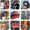
This StoryMap expands on Cadasta's participatory mapping approach, highlighting work in the Democratic Republic of the Congo, documenting community lands, strengthening customary tenure, and formalizing rights in one of the world’s most critical rainforest regions. It illustrates how participatory methods strengthen governance and local leadership and protect forests. Explore the StoryMap →
Innovation Comes from Adaptation


Innovation in land governance is rarely about introducing entirely new technology. More often, it comes from adapting proven approaches to local realities.

Every partnership presents different legal frameworks, technical capacity, environmental conditions, and governance priorities. Rather than deploying a fixed model, implementation is tailored to those realities while maintaining a consistent foundation: practical technology, interoperable data, local ownership, capacity strengthening, and long-term sustainability.

That flexibility enables partners to build solutions that fit their institutions instead of forcing institutions to fit the technology. It is also why approaches developed across Indigenous land tenure, land administration modernization, community forestry, and climate resilience continue to produce value in very different settings.

Screenshot 2026 07 07 at 6.42.02 PM
Ten Years of Learning Through Implementation

A decade ago, the focus was on expanding access to community mapping. Today, partnerships span more than 40 countries and support governments, Indigenous Peoples, civil society organizations, and local institutions working to strengthen land tenure through enterprise geospatial solutions developed in collaboration with Esri, the global leader in geographic information systems (GIS). This StoryMap illustrates not only how the work has evolved, but how continuous learning has shaped the implementation approach partners rely on today. Explore the StoryMap →

From Insight to Implementation

As land governance becomes increasingly connected to climate adaptation, infrastructure planning, conservation, food security, and economic development, organizations need more than technical tools. They need implementation partners who understand how technology, institutions, and communities work together.

That is the role Cadasta brings to every partnership.

Cadasta’s work sits at the intersection of technology, implementation, and capacity strengthening. By combining enterprise GIS solutions, participatory methodologies, and deep implementation experience, Cadasta helps governments, civil society organizations, and development partners design land governance programs that are technically sound, locally led, and built for long-term sustainability.

The StoryMaps featured here are more than stories.

They are field-tested examples of how those approaches are applied in practice, offering insights that partners can adapt to their own contexts while illustrating the collaborative process behind successful implementation.

Whether you’re modernizing a land administration system, strengthening community land tenure, improving geospatial decision-making, or designing a new land governance initiative, these examples provide a window into what effective implementation looks like and what becomes possible when trusted partnerships, local leadership, and practical technology come together.

Explore the StoryMaps collection to discover implementation insights, proven approaches, and real-world examples that continue to shape the future of secure land tenure.

SHARE POST