

A Decade of Progress

In 2025, Cadasta’s work moved more decisively from documenting land to strengthening the systems that make land rights actionable.
Community-led documentation remains the foundation. But across geographies, the focus shifted toward ensuring that this data can be used by governments, institutions, and donors without losing its integrity, ownership, or context. This means strengthening not only how data is collected, but how it is governed, integrated, and applied in real-world decision-making.
Across contexts, a consistent pattern is emerging. When community knowledge is translated into credible, shared evidence, it does more than record land. It reduces disputes, clarifies rights, and enables action.
The examples below show how this shift is taking shape in practice, from community-led data collection to national land administration, from Indigenous governance to crisis response.
Climate, Data, and Systems at Scale
In 2025, Cadasta expanded its data solutions to help partners make better use of community-generated land data beyond individual projects. This work focused on strengthening the full data lifecycle—from aggregation and validation to visualization and use—while maintaining community ownership and control.
In the Tropical Andes, this took shape through support to an ecosystem partner working in Bolivia, Colombia, Ecuador, and Peru. Cadasta aggregated, cleaned, and processed territorial data submitted by partner organizations and developed geospatial products to support portfolio-level analysis. The resulting data sets consolidated territorial information across multiple countries and projects, enabling partners to better visualize land tenure status and track progress across their portfolios.
Cadasta provided similar data solutions to ecosystem partners that fund and coordinate multi-country land rights initiatives. By designing and implementing integrated GIS workflows and products, Cadasta helped harmonize territorial and project data across portfolios. These systems enable partners to track indicators, visualize the footprint of their investments, and strengthen reporting to their own stakeholders.
As land and tenure data become more central to climate and development strategies, protecting the communities behind that data is essential. In 2025, Cadasta formally endorsed the Better Deal for Data Standard and expanded internal and partner capacity on data governance. This work reinforces consent-based data practices, safeguards sensitive information, and supports long-term stewardship.
Together, these efforts position Cadasta to play a stronger role in connecting community-generated data with the systems and tools needed to support more informed land and resource governance over time.
Indigenous Leadership and Territorial Documentation
Cadasta’s work in forested landscapes is grounded in supporting communities in documenting and validating their land and resource use through participatory processes. Across diverse contexts, the focus has been on providing tools and technical support that enable Indigenous Peoples and local communities to map their territories, strengthen evidence of their presence, and, where relevant, pursue formal recognition.
Through the Strengthening Land and Forest Rights Program, supported by UK International Development from the UK Government, communities identified and validated more than 4.5 million hectares of forested land. Over 300,000 hectares were submitted for formal recognition, and more than 100,000 hectares have been legally recognized to date. The program also supported the documentation of more than 518,800 people, nearly half of them women, and reached over 80,000 people through land rights outreach and awareness.
Participatory mapping played a central role across all geographies. By translating lived knowledge into structured, verifiable data, communities were able to clarify boundaries, surface and address overlapping claims, and strengthen the evidence base that can be used in engagement with governments and other stakeholders.
This is particularly evident in the Democratic Republic of the Congo, where Cadasta worked with Solidarité pour la Promotion des Femmes Autochtones (SPFA) and local communities to support participatory mapping and boundary validation. Community members, neighboring leaders, and customary authorities came together to review mapped boundaries and formally validate them through signed agreements. These processes transform maps into shared, recognized records, reducing the risk of future disputes and strengthening the legitimacy of documented boundaries.
Similar approaches were used across other partnerships. Maya communities in southern Belize documented more than 25,000 hectares of ancestral land. In Ecuador, Indigenous federations resolved long-standing territorial conflicts across more than 100,000 hectares. In Myanmar, communities documented customary land use across large forested areas, thereby strengthening locally held tenure records.
Women and youth played a central role throughout these efforts, leading mapping activities, supporting data collection, and contributing to how information is maintained and used within their communities.
Together, these examples highlight the value of credible, community-generated data. While documentation alone does not resolve all land tenure challenges, it provides a critical foundation for communities to articulate their claims, reduce conflict, and engage with external actors from a stronger position.
Advising Governments for Improved Land Systems
Across many contexts, governments face a consistent challenge to create land systems that are accurate, accessible, and responsive to how land is actually held and used. Small gaps in data, processes, or valuation can slow recognition, create inefficiencies, and limit the effectiveness of land services.
In 2025, Cadasta provided targeted technical support to government institutions to strengthen specific components of land administration systems, focusing on practical improvements to data, workflows, and methodologies.
In Malawi, Cadasta supported the Malawi Land Productivity Project, funded by the Millennium Challenge Corporation (MCC), by assessing the costs of decentralized land services and developing updated approaches to ground rent valuation for public lands. This work aimed to make land-related fees more transparent and better aligned with actual land use conditions.
In Togo, Cadasta supported the Land Reform to Accelerate Agricultural Productivity project, funded by the Millennium Challenge Account (MCA), by testing and refining tenure methodologies in practice. This included simplifying processes for smallholder farmers and integrating gender-inclusive approaches to make land services more accessible and inclusive. By focusing on how systems function at the user level, this work helps make land administration processes more practical and responsive to the needs of rural communities.
In Uganda, collaboration with the Ministry of Lands, Housing, and Urban Development supported the documentation of more than 5,000 parcels for eventual Customary Certificates of Ownership. The focus was on improving how land information is collected and validated at the local level, helping ensure that documentation aligns with government requirements while remaining accessible to customary communities.
Together, these examples show how targeted, technical interventions can strengthen how land systems function in practice, improve data quality, reduce friction in administrative processes, and support more consistent and equitable service delivery.
Securing Rural Livelihoods and Farmer Resilience
These system improvements have direct implications for rural livelihoods, where unclear or insecure land tenure can limit farmers’ ability to plan, invest, and manage their land over time.
In Rwanda, Cadasta partnered with Landesa and the Rwanda National Land Authority through the Rwanda Agricultural Systems Change Initiative, funded by Co-Impact. The focus was not on issuing new rights, but on strengthening the quality and completeness of existing land records by documenting missing land attribute data.
In practice, this meant working with farmers and local authorities to correct and update parcel-level information to ensure that land records more accurately reflect how land is held and used. With clearer and more reliable documentation, farmers have greater confidence in their land tenure. This clarity reduces the risk of disputes and increases farmers’ willingness to invest in their land, whether through improved agricultural practices, soil management, or longer-term planning. While access to government programs and extension services does not always depend on formal title, more accurate records strengthen how these services are delivered and used in practice.
Humanitarian Housing
The importance of reliable land and housing data becomes even clearer when working to improve living conditions at scale, where accuracy, consistency, and equity directly shape who is reached and how.
Across Latin America and the Caribbean, Cadasta partnered with Habitat for Humanity International to strengthen housing programs through GIS-enabled data systems. This regional effort aims to replace 100,000 dirt floors with safe, concrete surfaces by 2028, improving health, safety, and dignity for families across ten countries.
Cadasta strengthened the data foundation behind this work by standardizing household data, improving GIS mapping accuracy, and building a unified monitoring, evaluation, and learning system. These improvements increased assessment capacity by 3.5 times, enabling faster identification of households and more efficient program delivery.
This work also reinforces the link between housing improvements and tenure security. By documenting upgrades and linking them to reliable data systems, families gain stronger evidence of their occupancy and investment, supporting greater stability over time.
Together, this collaboration shows how stronger data systems can translate into tangible improvements in daily life, turning incremental upgrades into scalable pathways toward safer housing.
From Data to Decisions
Community-generated data is increasingly being used not just to document land, but to inform decisions and resolve disputes. It is increasingly used to resolve disputes, inform decisions, and shape the systems that govern land, climate, and development outcomes.
Cadasta’s role is evolving alongside this shift, from supporting individual projects to strengthening the data, systems, and partnerships that make secure land and resource rights durable at scale.
Communities Engaded
Work Conducted in 44 Countries
Official Land Documents Supported
Collaboration with 27 Government Partners
Parcels Documented
A Decade of Impact
Cadasta's Influence Beyond Projects
Driving Thought Leadership and Global Advocacy
In 2025, Cadasta deepened its role as a global thought leader and advocate, ensuring that community-led, evidence-informed perspectives shaped international conversations on land, climate, and development.
Cadasta launched the Mapping Change webinar series to showcase the work of our partners representing Indigenous Peoples and Local communities. Sessions in June featured partners from Ghana and Belize, highlighting how community-led mapping strengthens tenure security while supporting biodiversity protection and climate resilience. September sessions focused on Myanmar and Colombia, demonstrating Indigenous leadership in forest protection and territorial governance amid escalating environmental pressure.
Cadasta also expanded its public voice through targeted media and thought leadership. Highlights included an op-ed by CEO Amy Coughenour Betancourt in SustainabilityX discussing the link between secure land tenure and effective climate action, a Geospatial World interview exploring Cadasta’s use of geospatial technology to advance land rights and gender equity, and a ten-year anniversary feature in ArcNews reflecting on Cadasta’s evolution and achievements.
Throughout the year, Cadasta engaged in major international forums, including Climate Week NYC, the World Bank Land Conference, the Global Land Forum, the International Land and Development Conference, and the Skoll World Forum. Across these spaces and through our publications and social media engagement, Cadasta consistently advanced a core message that secure land and resource rights are foundational to climate resilience, biodiversity protection, and social justice.
A Decade of Impact
Looking Ahead
Three Pillars for the Next Decade
As Cadasta enters its second decade, the organization’s focus shifts from simply demonstrating what works to embedding land tenure security within systems that endure. Guided by its 2026 strategy, Cadasta’s work will be anchored around three interconnected pillars across forests, farms, and coasts.
Strengthen Participatory Mapping and Monitoring for Tenure, Livelihoods, and Climate
Bring Land Into View
Cadasta partners with frontline organizations and communities to map, secure, and monitor lands through technology, training, and expertise. These participatory efforts support land-use plans, livelihood opportunities, and climate actions. Frontline organizations and communities are better equipped to understand their rights and data, track progress, monitor threats, and manage resources.
Where: Climate and biodiversity hotspots in forests, agricultural, pastoralist, coastal, and protected lands in the Congo Basin, East and West Africa, Amazon Basin, Southeast Asia, and Mesoamerica.
Key Activities:
Strengthening Land and Forest Rights- UK International Development
Location: 12 countries across Latin America, Sub-Saharan Africa, and Asia
This project provides critical support to Indigenous Peoples and Local Communities (IPs & LCs) to secure their land, forest, and resource rights. In partnership with 13 organizations across 12 countries (Latin America, Sub-Saharan Africa, Asia), Cadasta provides grants, technology, training, and technical assistance to map, document, secure, and monitor land and resource rights. By strengthening organizational technical capacity, the initiative bolsters forest tenure and climate outcomes.
Community Mapping for Land and Climate
Funder: Swedish Postcode Lottery
Location: Argentina, DRC, and Papua New Guinea
Cadasta will continue working with partners to strengthen community land documentation and data systems—helping communities move toward formal recognition and long-term tenure security. In Papua New Guinea, in partnership with Cool Earth, we will support a Rainforest Lab model to map and secure conservation deeds that recognize Indigenous Peoples’ rights, improve forest monitoring, and support community-led stewardship.
Securing Land Rights of indigenous Pygmy Peoples with Legal Land Documents
Funder: Jacob Futura Foundation
Location: Democratic Republic of the Congo
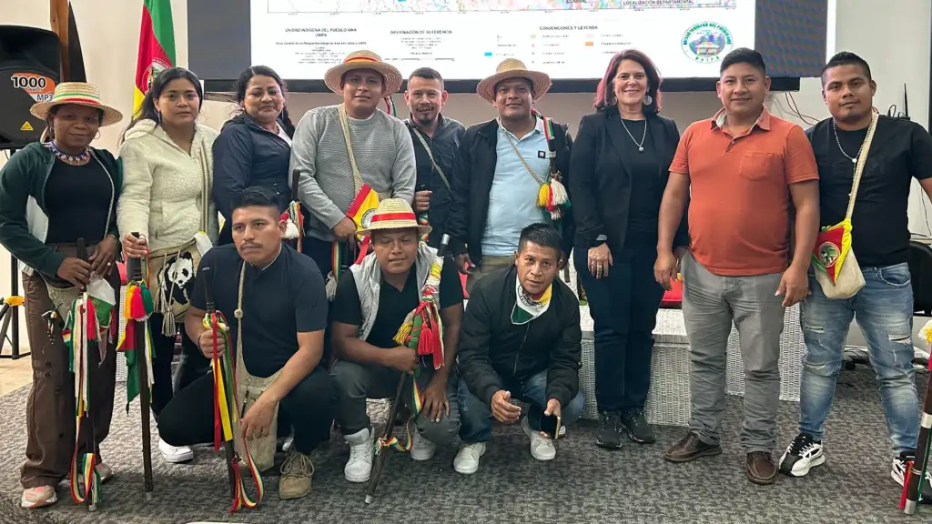
Cadasta will work with SPFA to complete final data validation for nine community lands—an essential step toward formal recognition and enforceable rights. We work with the National Land Reform Commission (CONAREF) to support dialogue, clarity, and alignment on evolving legal frameworks, strengthening shared understanding and accelerating community land recognition and stewardship.
Enable More Inclusive and Effective Land Systems
Turn Maps Into Rights
Cadasta partners with land agencies, local governments, and communities to strengthen land administration by building capacity to use bottom-up, digital tools for mapping, land use planning, and tenure formalization.
We support efforts to link community-generated data to national land information systems, helping governments recognize land rights more efficiently and equitably while improving transparency, service delivery, and long-term system performance.
Where: Sub-Saharan Africa
Key Activities:
Scaling Community Land Rights in Uganda
Funder: Rising Tide Foundation
Location: Uganda
The project will finalize district-level validation of Customary Certificates of Ownership (CCOs) and, in partnership with Uganda’s Ministry of Land, support their full integration into their National Land Information System. This step strengthens legal recognition, aligns with national systems, and ensures community land documentation is secure, usable, and built to last.
Agricultural Systems Strengthening Project
Funder: Landesa
Location: Rwanda
In collaboration with the National Land Authority and Landesa, the project will finalize data processing for title holders who need boundary corrections or missing information addressed. This work strengthens the accuracy, integrity, and legal reliability of land records—ensuring they can be trusted and upheld.
Land Reform for Agricultural Productivity
Funder: VNG International
Location: Togo
This Millennium Challenge Corporation (MCC) Compact project (2022-2025) supported the Government of Togo in developing and testing approaches to map rural landholdings to increase farmer productivity and strengthen land systems. In 2026, our team will document the status of work and provide practical recommendations for the Government of Togo to consider as it explores future funding to carry the effort forward.
Increase Access to Critical Data Solutions and Services
Power Progress With Data
Cadasta provides geospatial tools and data services to civil society partners, re-granting organizations, and donors working on land rights and climate outcomes across sectors and regions. By using geospatial tools and data analysis, Cadasta builds partners’ capacity to track progress, visualize impact, and make better decisions. We also create new solutions to respond to evolving needs in areas such as land tenure, deforestation monitoring, conservation, land use planning, biodiversity tracking, blue commons, and other sectors.
Cadasta is positioned to provide technical support to implement large global commitments, such as the $1.8 billion International Land Tenure Pledge made at COP30 in 2025 by the Forest Tenure Funders Group. Similar opportunities are the Tropical Forest Forever Facility and the Forest Climate Leaders’ Partnership (FCLP), which aims to recognize and sustainably manage at least 160 million hectares of Indigenous Peoples’, local communities’, and Afro-descendant communities’ lands by 2030.
Where: Global
Key Activities:
Data Solutions for Ecosystem Partners
We will provide integrated geospatial and data management solutions to ecosystem partners, including Tenure Facility and others, to strengthen evidence generation, coordination, and impact tracking across global tenure and climate portfolios. By aligning field-level documentation with standardized indicators, interoperable data systems, and high-quality spatial analysis, we will support partners in measuring progress, informing advocacy, and driving more strategic investments in Indigenous and community land rights.
IMPACT STATEMENT
In 2026, we will strengthen rights and improve the lives of 10,000 people living on 50,000 hectares of land in climate hotspots in 10 countries. Over the next decade, Cadasta remains committed to helping build more inclusive land rights and the systems that support them in partnership with communities, frontline organizations, donors, and governments worldwide.